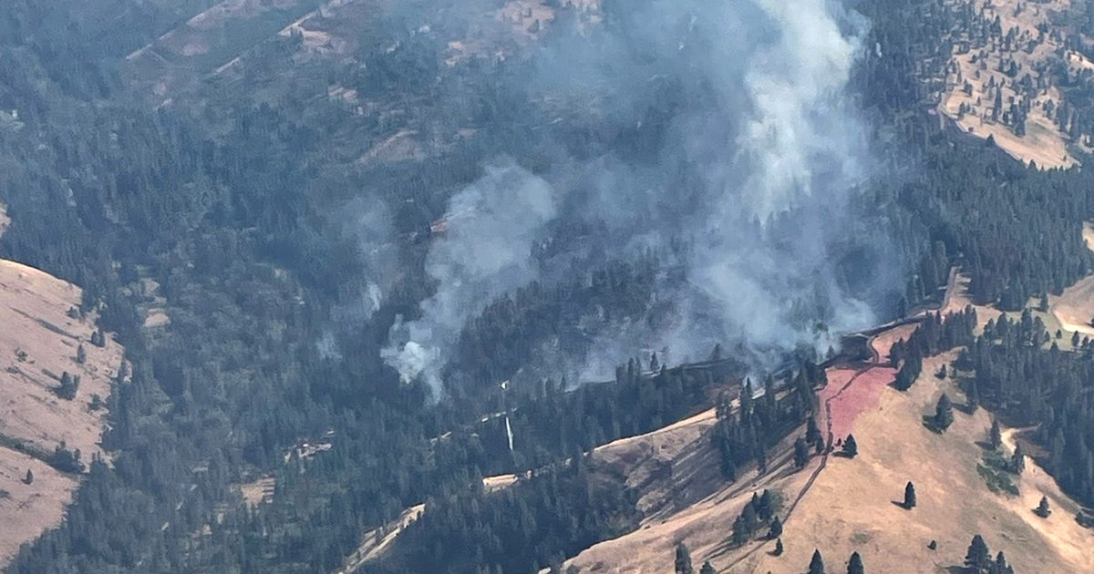
One of the recent fires on the Umatilla National Forest has been controlled and no new fires were discovered on the forest. “Everything continues to hold, the fires are becoming more stable,” said Tyson Albrecht, Umatilla Deputy Fire Staff.
Suppression efforts will continue today on all incidents and most fires remain at less than five acres in size, except Forks Fire on the North Fork John Day Ranger District which is still at 20 acres.
North Fork John Day Ranger District
• The Forks Fire in the Silver Butte Area, 23 miles southeast of Ukiah, OR. Currently at 20 acres.
• The Bowman Fire in the Rancheria Creek Area, 12 miles northeast of Ukiah, OR. Currently at 2 acres.
North Fork John Day Ranger Districts Continuing Incidents
• The Double Snag Fire in the Winom Creek Area is 85% contained at 131 acres.
Walla Walla Ranger District
• The Milk Fire in the Milk Shakes Area, 17 miles southeast of Walla Walla, WA. Currently 1 acre.
• The Lookout Fire in the Bear Creek Area, 24 miles southeast of Walla Walla, WA. CONTROLLED at .1 acre.
• The Bear Creek Fire in the Bear Creek Area, 26 miles southeast of Walla Walla, WA. Currently 2.5 acres.
Pomeroy Ranger District – All fires are in the Wenaha-Tucannon Wilderness Area.
• The Shoo Fly Fire in the Milk Creek Area, 20 miles southeast of Walla Walla, WA. Currently at .25 acre.
• The Beaver Ridge Fire in the Beaver Ridge Area, 20 miles east of Walla Walla, WA. Currently at .1 acre.
• The South Fork fire in the Elk Creek area, 22 miles southeast of Walla Walla, WA. Currently at .25 acre.
Umatilla Fire staff continue to support the Washington Department of Natural Resources in their response to the Wolf Fork Fire which is currently 50 acres near the North Touchet Road and 20 miles northeast of Walla Walla, Washington.
Hot and dry conditions are expected to persist, and officials want to remind everyone that the current fire danger rating is at EXTREME and Public Use Restrictions involving chainsaw use and campfires are in effect.
Multiple fire related temporary area closures are in effect for Umatilla National Forest. Forest Closure descriptions and maps are available at https://www.fs.usda.gov/detail/umatilla/alerts-notices/?cid=stelprdb5286768.
In addition, the following incidents are burning on or near the Umatilla National Forest and are being managed by partner agencies and Complex Incident Management Teams.
• Battle Mountain Complex: https://inciweb.wildfire.gov/incident-information/or97s-battle-mountain-complex
• Cougar Creek Fire: https://inciweb.wildfire.gov/incident-information/wases-cougar-creek-fire
• Lone Rock Fire: https://inciweb.wildfire.gov/incident-information/orprd-lone-rock-fire
More information regarding restrictions contact:
Umatilla National Forest:
Information Hotline: Toll-Free (877) 958-9663
X: @UmatillaNF
The latest fire information will be posted on the Blue Mountains Fire Information Blog.
To receive updates on fires in the Blue Mountains, follow the blog at http://bluemountainfireinfo.blogspot.com/.
Additional information about the Umatilla National Forest is available at http://www.fs.usda.gov/umatilla.